


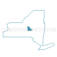
Voting District 080001, Madison County, New York
About
Outline

Summary
| Unique Area Identifier | 629656 |
| Name | Voting District 080001 |
| County | Madison County |
| State | New York |
| Area (square miles) | 23.75 |
| Land Area (square miles) | 23.68 |
| Water Area (square miles) | 0.07 |
| % of Land Area | 99.70 |
| % of Water Area | 0.30 |
| Latitude of the Internal Point | 42.77991660 |
| Longtitude of the Internal Point | -75.66164230 |
Maps


Graphs
Select a template below for downloading or customizing gragh for Voting District 080001, Madison County, New York


Neighbors
Neighoring Voting District (by Name) Neighboring Voting District on the Map
- Voting District 040002, Madison County, NY
- Voting District 040003, Madison County, NY
- Voting District 060001, Madison County, NY
- Voting District 080002, Madison County, NY
- Voting District 120001, Madison County, NY
- Voting District 140001, Chenango County, NY
- Voting District 220001, Chenango County, NY
Top 10 Neighboring County Subdivision (by Population) Neighboring County Subdivision on the Map
- Eaton town, Madison County, NY (5,255)
- Nelson town, Madison County, NY (1,980)
- Lebanon town, Madison County, NY (1,332)
- Smyrna town, Chenango County, NY (1,280)
- Otselic town, Chenango County, NY (1,054)
- Georgetown town, Madison County, NY (974)
Top 10 Neighboring Unified School District (by Population) Neighboring Unified School District on the Map
- Sherburne-Earlville Central School District, NY (8,599)
- Hamilton Central School District, NY (7,189)
- Morrisville-Eaton Central School District, NY (6,716)
- Georgetown-South Otselic Central School District, NY (2,745)
Top 10 Neighboring State Legislative District Lower Chamber (by Population) Neighboring State Legislative District Lower Chamber on the Map
Top 10 Neighboring State Legislative District Upper Chamber (by Population) Neighboring State Legislative District Upper Chamber on the Map
Top 10 Neighboring 111th Congressional District (by Population) Neighboring 111th Congressional District on the Map
Top 10 Neighboring Census Tract (by Population) Neighboring Census Tract on the Map
- Census Tract 307, Madison County, NY (7,235)
- Census Tract 9701, Chenango County, NY (6,077)
- Census Tract 9702, Chenango County, NY (4,622)
- Census Tract 308, Madison County, NY (3,895)